Imagining Imperial Spaces: Comparing Cartographic Representations of the Great Lakes Region in the 17th and 18th Century
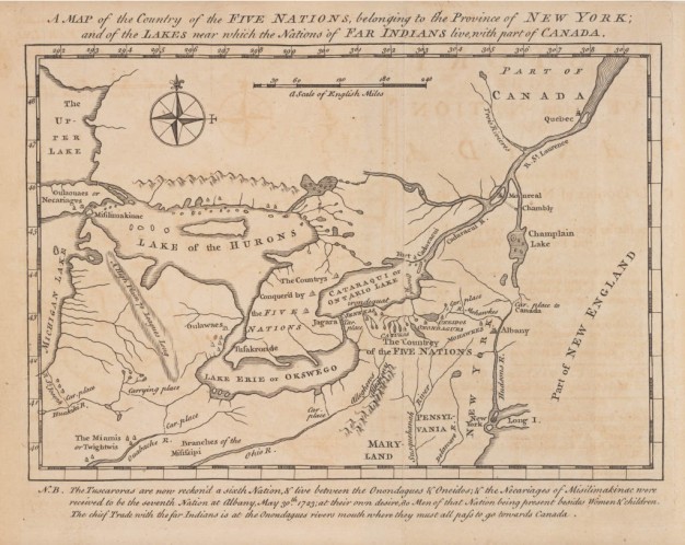
Header Image: Cadwallader Colden’s A map of the countrey of the Five Nations. Created by French cartographer Guillaume Delisle, and published with Colden’s book in 1724. Source: APS, 970.1: C67p.
In March 2025, I had the opportunity to visit the APS as a David Center for the American Revolution International Fellow to conduct research for a new project. The goal of this project is to explore the growth of geographic knowledge in North America and its relationship to the evolution of map-making and cartographic comprehension of the Great Lakes in Europe.
While at the APS, with the help of the wonderful reference staff, librarians, and experts, I focused on two different genres of sources to explore how diverse peoples understood, interacted with, and described their surroundings, and how these experiences and understandings were communicated along the intricate waterways of the continent and across the Atlantic to France. Most of the sources appear in the Society’s Early American History Collection.
The first part of this research utilized maps of the Great Lakes region, produced in North America and Europe. One example at the APS is the 1724 map, A map of the countrey of the Five Nations …, created by Guillaume Delisle, and included in Cadwallader Colden’s book, The History of the Five Indian Nations … (the Haudenosaunee). Although the map does not depict the Great Lakes as we know them, it provides insight into one conception of this region at this time. It is especially interesting that Delisle never visited North America. As a part of my larger efforts to chronologically trace cartographic representations of this region, Delisle’s map contributes to my exploration of evolving geospatial depictions.
The next part of my research at the APS examined descriptions of European exploration, missional activities, interactions with diverse Indigenous peoples, and geographic details contained in historical manuscripts, unpublished exploration and military journals, correspondence, and other oral, visual, and textual sources. Information compiled on the ground during missions, exploration, and diplomatic and commercial encounters are useful to examine how specific geographic, topographic, and demographic details were recorded, communicated, and eventually presented or omitted from maps produced in Europe. These sources also provide interesting details about individual experience, topography, the natural environment, and Indigenous-European interactions.
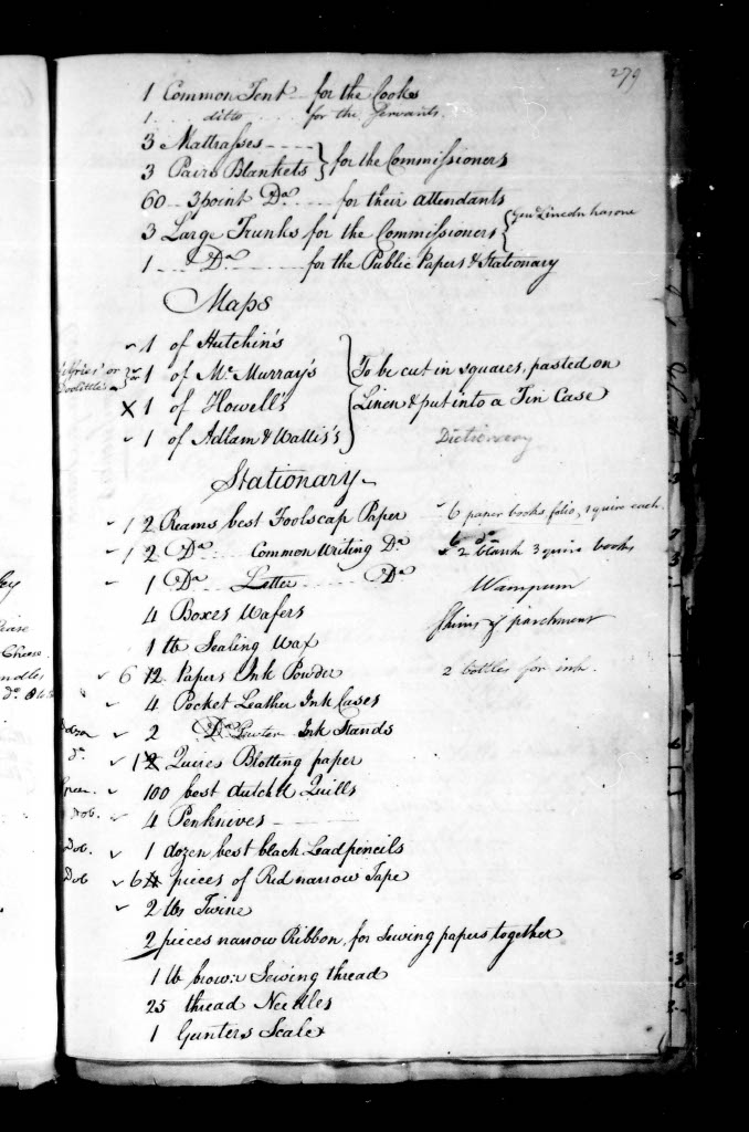
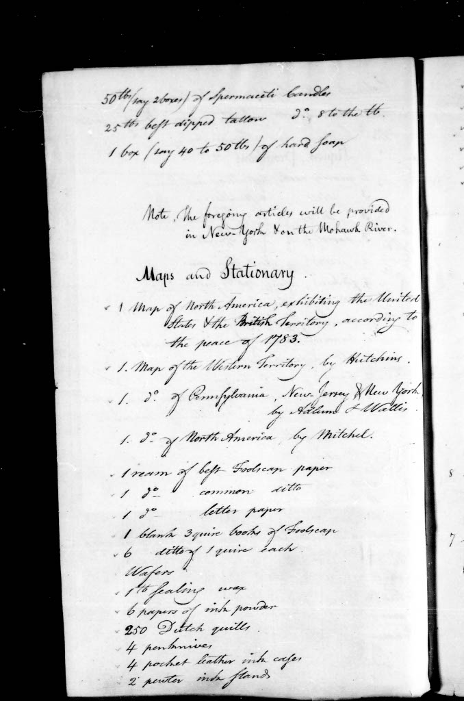
As I delved further into these sources, I made a surprising, and exciting discovery. Timothy Pickering’s Papers on Indian Affairs, recorded from 1790-1796, include expedition supply lists. In addition to more typical travel supplies, these lists mention the addition of specific historical maps, including one of the Western Territory by American military engineer, geographer, and surveyor, Thomas Hutchins, and another map of North America by John Mitchell. Although I have spent most of my research time immersed in the seventeenth and early eighteenth centuries, I have not come across a supply list like this before. It is an interesting example of the dissemination and distribution of geospatial knowledge and the use of “official” cartographic sources on the continent. This find has opened an exciting new direction and source base for my ongoing research, which I look forward to exploring further!