Header Image: Crop of Poupard, James, and Benjamin Franklin. A chart of the Gulf Stream. Philadelphia, Pa.: American Philosophical Society, 1786. Map. https://www.loc.gov/item/2004627238/.
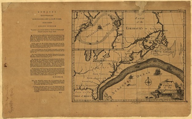
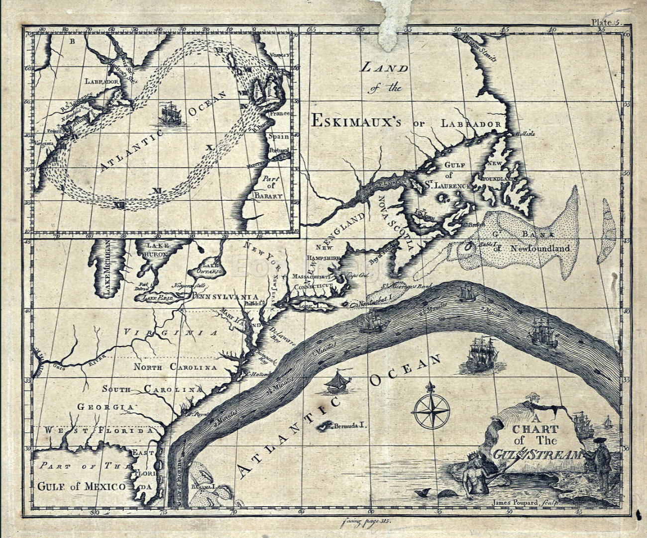
If you were to leaf through the second volume of Transactions printed in 1786, you'd be confronted with a treasure trove of peculiar treatises, all vying for your attention. There is Henry Flagg Collins' "Observations on the Numb Fish, or Torporific Eel," a report on the efficacy of "cancer powder," and a piece ominously titled "Account of a Worm in a Horse's Eye." Between these more esoteric dispatches, you'd come across a discovery of lasting consequence: the first printed map of the "Gulph Stream," as envisioned by Benjamin Franklin, in his contribution, “A Letter from Dr. Benjamin Franklin, to Mr. Alphonsus le Roy, Member of Several Academies, at Paris. Containing Sundry Maritime Observations.”
Franklin was only 31 when he was appointed postmaster of Philadelphia 289 years ago, an anniversary marked in this year's "52 Weeks of Firsts" celebrations. The stakes were existential, as the postmaster held the authority to circulate or censor information as he pleased. His predecessor had been a rival newspaperman who banned delivery of Franklin's Pennsylvania Gazette outright. Franklin shrewdly capitalized on his new station, recalling that "tho' the salary was small, it facilitated the correspondence that improv'd my newspaper, increas'd the number demanded[...]so that it came to afford me a considerable income." Eventually stripped of his role by the Crown, Franklin would return in 1775 as the first Postmaster General of the United States. One postal puzzle still eluded him: why did British mail ships crossing the Atlantic keep arriving weeks behind their American counterparts?
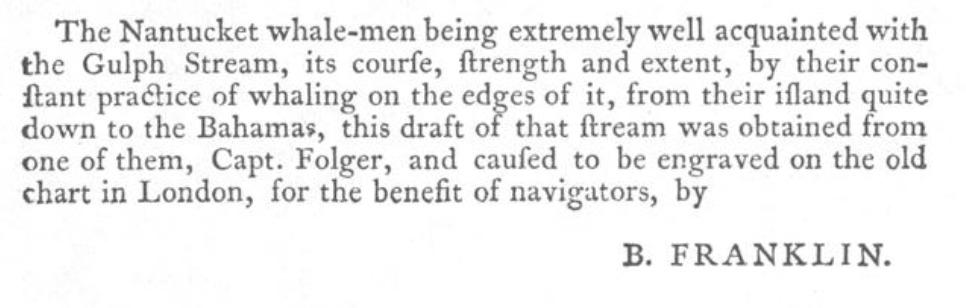
Franklin consulted "a Nantucket sea-captain of my acquaintance" — his cousin, Timothy Folger — who explained the discrepancy. American sailors had known for generations that whales kept to the edges of a powerful Atlantic current, and knew how to navigate accordingly. In Franklin's words, the whalers' warnings to the British had been dismissed as they thought themselves "too wise to be counselled by simple American fishermen." Strikingly, Franklin's Transactions piece credits his sources in full. The chart was devised by "Nantucket whale-men being extremely well acquainted with the Gulph Stream" and sent to be "engraved on the old chart in London, for the benefit of navigators, by B. Franklin." The local knowledge that the map communicated had been passed down for centuries. Its legitimization as “useful knowledge” through official networks was new.
These contradictions are at the heart of Networks: The Creation and Circulation of Knowledge from Franklin to Facebook, volume 111, part 4 of the American Philosophical Society’s Transactions. In 2017, the American Philosophical Society simultaneously digitized Franklin's postal ledgers and Warren S. McCulloch's papers for the Cybernetics Thought Collective, a resonant pairing that inspired this volume. While Franklin credited his informants, Networks essayist Peter C. Messer lingers on missing acknowledgments. In his piece on early botany in Philadelphia, he details how Benjamin Smith Barton's sprawling global network forged a new American natural history by challenging rigid European taxonomies. He also points out that Barton dismissed enslaved African Americans' observations of the "Hell-bender" salamander as "vulgar," and suppressed information about botanical abortifacients. Messer's central observation is just as salient in the age of Facebook: networks are not neutral structures. Franklin understood perhaps better than anyone that knowledge is only as useful as the networks that promote it.