
Pike and printed by Nicholas King, [1811]. Photo courtesy of the Library of Congress.
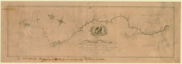
In the summer of 2019, I walked through the American Philosophical Society’s exhibition Mapping a Nation: Shaping the Early American Republic. Map after map told a complex story of Americans wrestling with the scale of the North American continent and determining the shape of its internal and external borders. Towards the end of the exhibit, one map stood out because it offered a somewhat different story than the boundary drawing process I watched unfold throughout the gallery. The Map of the Mississippi River from its Source to the Mouth of the Missouri (pictured above) by Zebulon Pike and printed by Nicholas King has no borders. Situated on a horizontal rectangle, the map presents the Mississippi River as the central axis of a long corridor, oriented with the top of the map in the east and tracing the river’s north-south flow from left to right. Beyond this central line was nothing—seemingly open space.
One reason I was so fascinated by the Pike map was that I had just finished reading Pike’s journals detailing the very same expedition up the Mississippi River which produced this map. What struck me was the way the map’s display seemed to mirror Pike’s journal. Staying within the corridor, Pike marked time and distance in the binary above and below a given point. This sort of note taking simplified space. No matter how many twists and turns the river took, the river could be represented in the linear language of upstream and downstream. The map achieved this by providing information in list-like form giving the names of tributaries where they enter the river but offering few other details about the conditions and extent of those streams.
Soon I learned that this was not the only map of a Louisiana Purchase Expedition to display information in this manner. Two others, also by King, represented William Dunbar (APS 1800) and Dr. George Hunter’s journey on the Washita River and Thomas Freeman and Peter Custis’ journey on the Red River. A picture was emerging of the river focus of western exploration. Thomas Jefferson orchestrated these expeditions in his dual presidencies of the United States and the APS. Rivers were central to his imperial strategy. If Jefferson could transform those rivers into routes, he would dominate the continent.
A dissertation and pandemic after my visit to the museum, I arrived at the APS in May of 2022 for a short-term fellowship hoping to see the journals of the expeditions which I had spent so much time thinking about. Yes, I had read the printed editions, but what was being lost in transcription? What clues could these artifacts hold about the collection and presentation of data?
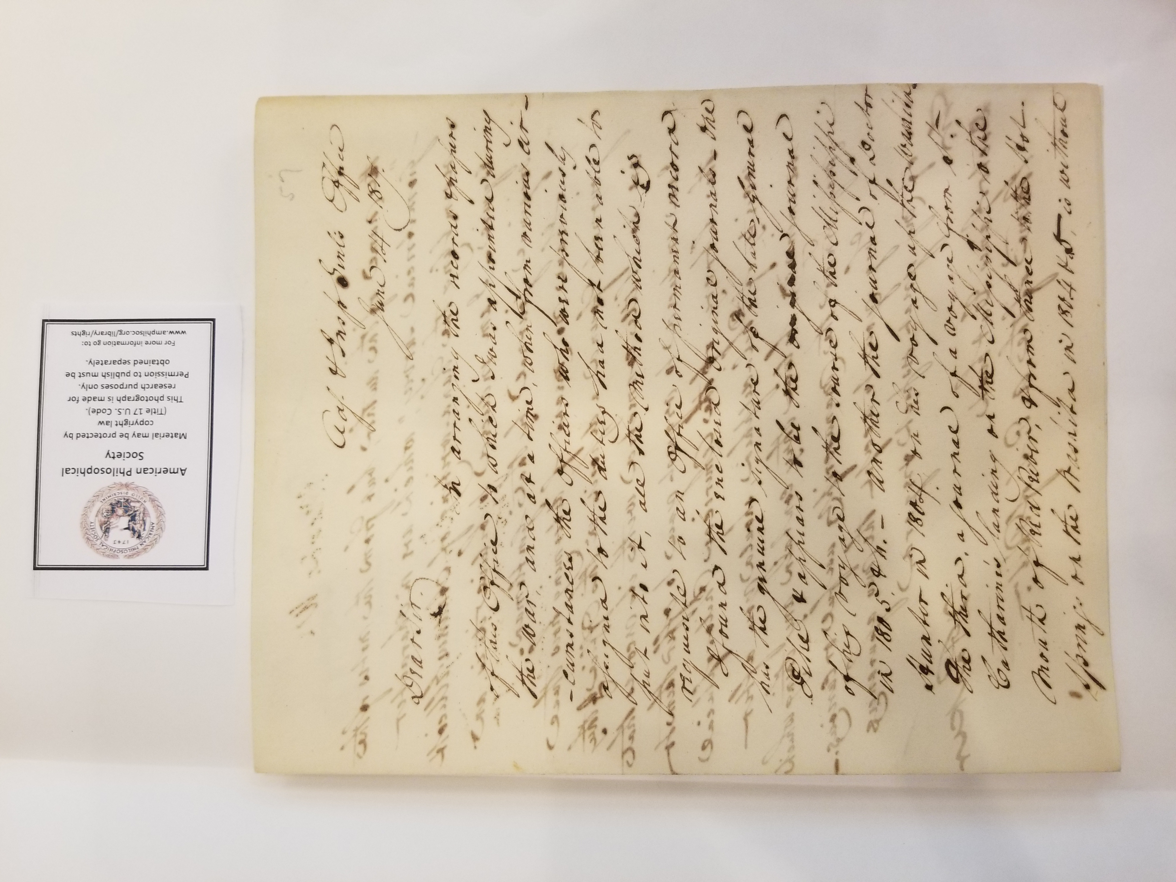
One thing that I found surprising was that the Expedition Journals of Pike and Dunbar were bound together. I soon followed a paper trail explaining how the journals arrived at the APS and perhaps why they were bound together. Daniel Parker sent the journals to chemist James Cutbush (APS 1814), writing that he found them while “arranging the records and papers of this office,” meaning that of the Adjutant & Inspector General, a post he held from 1814 to 1821. Parker mistakenly identified Dunbar’s journal as that of Andrew Ellicott (APS 1785). He had no idea how they ended up in his office. Cutbush then sent them on to APS librarian John Vaughan. The donation was recorded in the minutes of the APS on July 10, 1817. After over a decade, these journals were placed where their routes were first imagined.
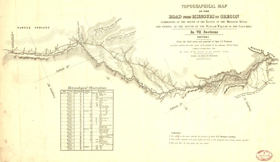
On my last day at the library, I looked at John C. Frémont’s Topographical Map of the Road from Missouri to Oregon (1846). There stretched out before me was a sight not unfamiliar: a linear depiction of a river system. Here, the Missouri and Snake Rivers had been connected and transformed into a road. The route taken by Frémont and his company is clearly represented along the bank. No one really believed there was a transcontinental water route at the time of the Louisiana Purchase. Instead, the network of rivers could be connected via canals and portages. Here, Frémont’s road provides the very connection that was speculated a half century before.
What matters is that rivers form physical and symbolic connections. The manner in which data was collected and represented reinforced these connections and did so at the expense of other qualities. The ecological benefits and sacred power of rivers were downplayed in these maps and by those who made them. This depiction of American rivers worked to justify the clearing, dredging, and canalizing that has irreversibly altered them. Maps have the power to connect people and places, but they also have the power to empty space. In these maps, rivers are imagined as connectors for those who are white, male, and upper class. Meanwhile the representation of “empty” and “open” spaces along their shores would justify the removal of Indigenous peoples and spaces which in turn would see the forced labor of enslaved African Americans. I wouldn’t go as far as to say that today’s issues of social and environmental justice were caused by maps. But the way we map matters.