
In the early decades of the 20th century, many anthropologists whose archival collections are housed at the APS’s Library & Museum used maps to try to work out their own theories on Indigenous peoples’ relationships with their ancestral lands and territories. These anthropologists’ notes, sometimes in very raw form, show up on top of printed maps that had been made for a variety of other specialized purposes. Reading the maps themselves, and not just what was scribbled or drawn on top of them, can tell us a great deal about the relationships that white settler societies, governments, and industries imagined and projected on these same lands.
For anthropologists such as Frank Speck and A. Irving Hallowell, who both worked extensively in Canada, the most useful maps for their purposes were those that provided a high level of detail on local landscape features while covering large regions overall. They would work out their notes on these maps of their understandings of particular Indigenous peoples’ uses of the land.
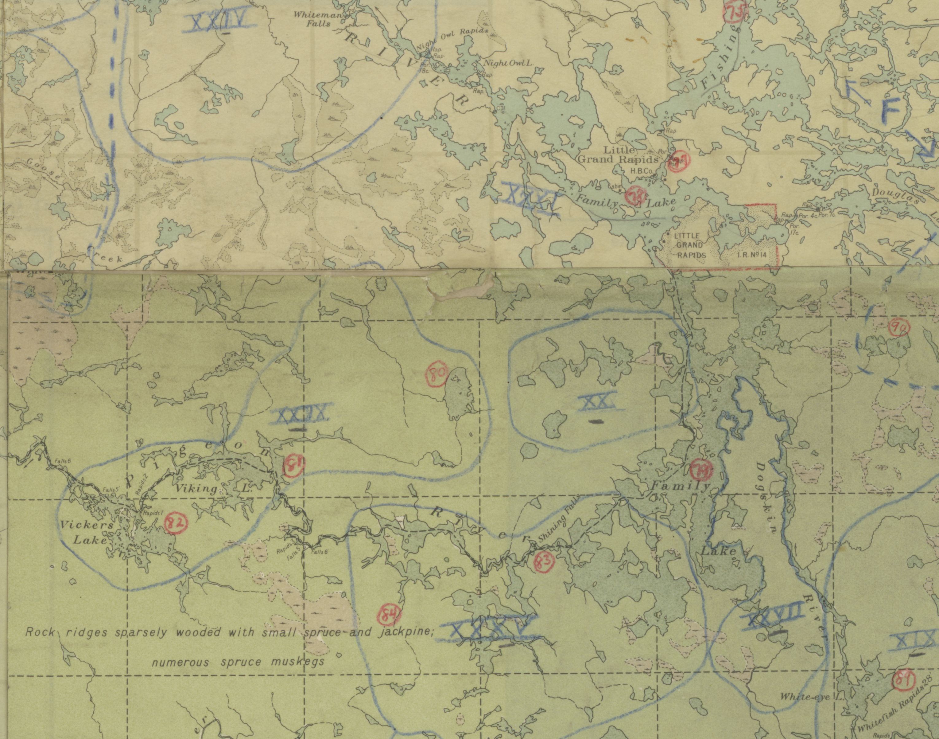
Such annotated maps often served as first drafts of maps that were later published, as can be seen with this later version of Hallowell’s map, yet the original shows relationships of these territories to more specific features of the landscape.
Maps annotated in this way were typically produced by government agencies such as the Department of the Interior, Département de Terres et Forêts, or more specific subdivisions such as the Geological Survey of Canada. The existence of these maps reflects the ongoing expansion of a settler nation (Canada) and its attempts to represent the land as known, named, and accounted for in categories that it regarded as important.
These maps show that anthropological and linguistic fieldwork in North America, particularly in the late 19th and early 20th centuries, often followed closely after the incursions of natural resource surveyors. When Indigenous knowledge, such as place names tied to ancestral stories, is annotated upon maps such as geological surveys, it indicates a different understanding of the land represented and a different relationship to it.
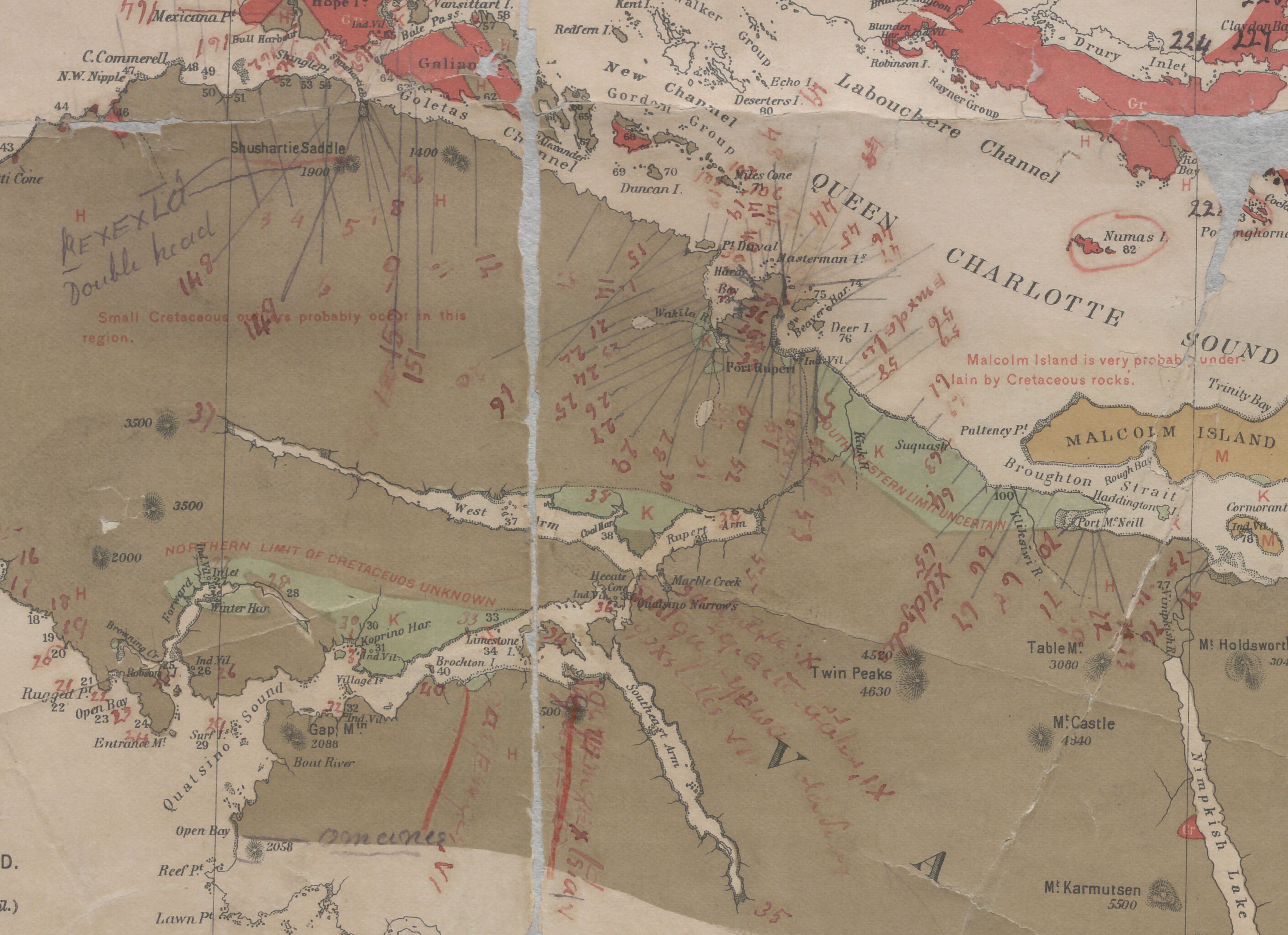
Franz Boas sent the above printed map to George Hunt, onto which Hunt added Kwakwaka’wakw place names (some translated) that he gathered from knowledgeable people in his and neighboring communities. The base map shows information such as geological formations, used in part to identify coal deposits and other areas for natural resource extraction. The place names, in contrast, attest to both broader and more specific knowledge of those territories, rooted in direct relationship with the places themselves.
The ethnographer James Teit used more common, publicly available maps for his annotations. These had one huge advantage: portability. Teit could fold these up and put them in his coat pocket as he traveled widely throughout British Columbia and the northwestern United States. Like the more specialized government maps, these printed maps also depict an overlay of categories important to settler nations—namely, political boundaries—upon Indigenous lands.
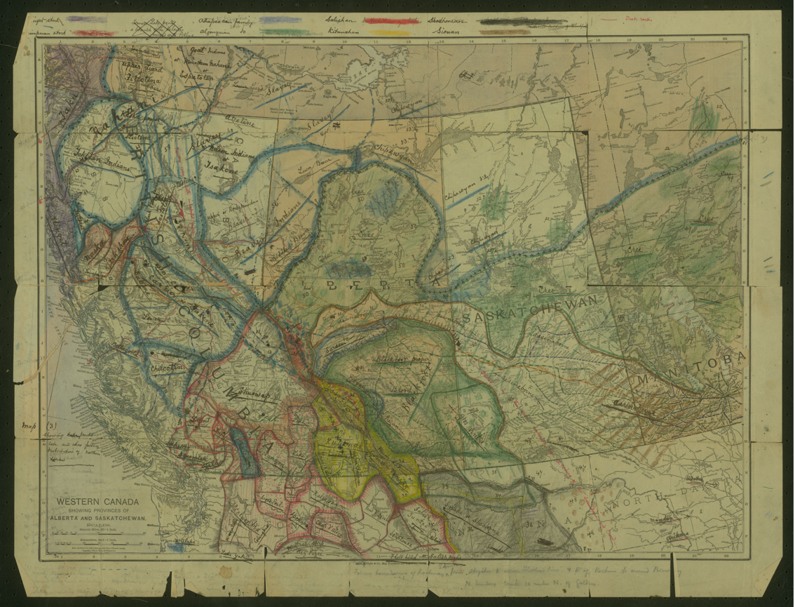
Here we see another sharp contrast in geographical depiction. Whereas the printed map overlays Canadian and American national and provincial boundaries upon the continent, Teit’s annotations show his understanding of Indigenous peoples’ territories over multiple time periods, including his own time, based upon discussions with Indigenous people throughout much of the region depicted. The full set of Teit’s annotated maps and accompanying notes in the Society’s collections show this contrast repeatedly.
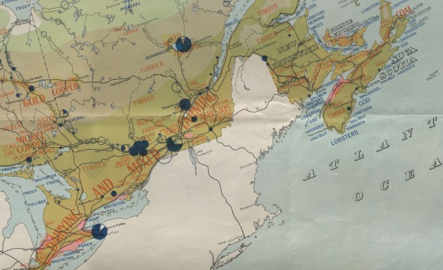
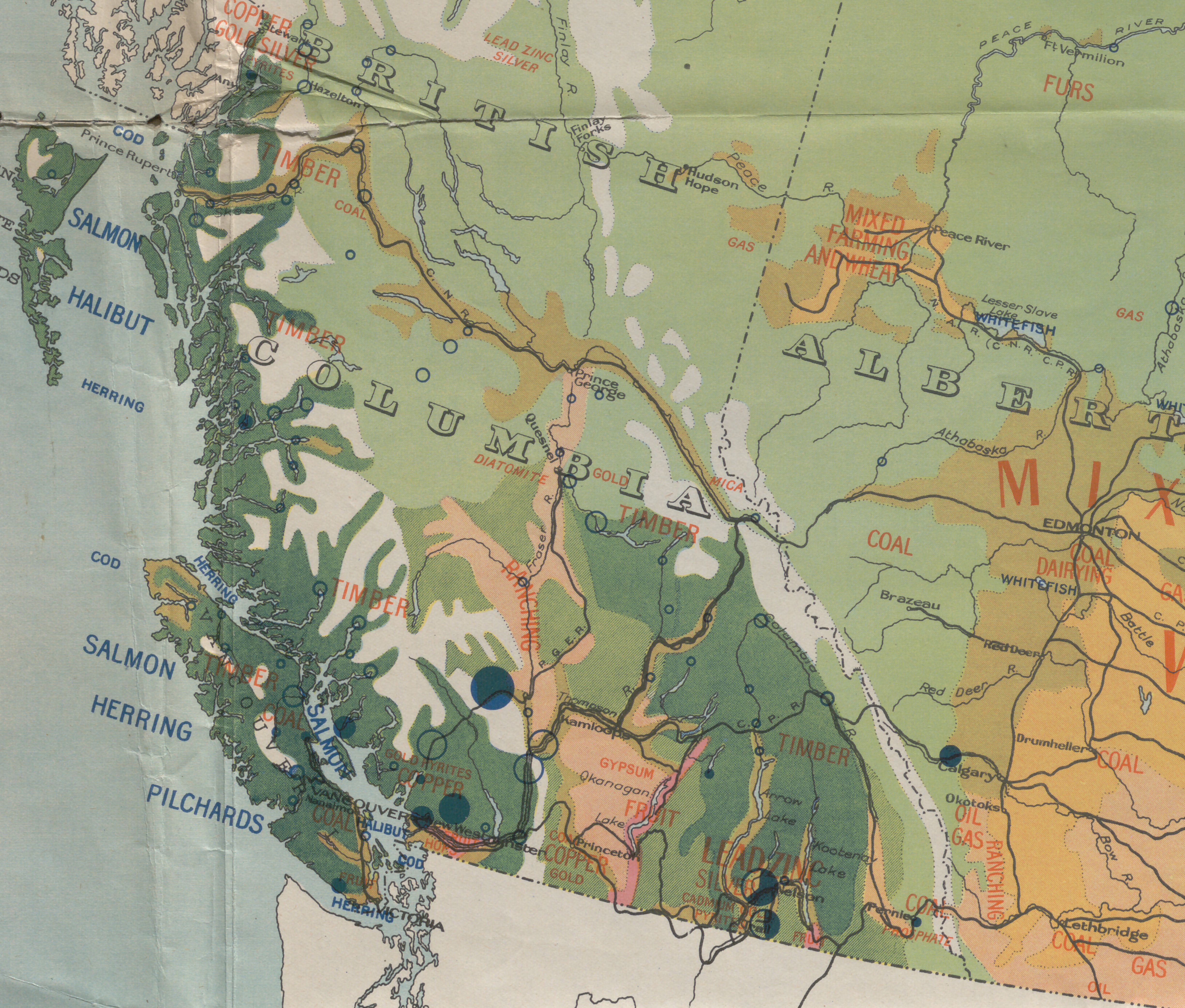
Finally, from examples like these we can learn to better recognize the erasure of Indigenous peoples in all sorts of maps. The map pictured below, produced by the Canadian Department of the Interior in 1930, emphasizes “main natural resources” across the continent, providing an especially brazen example of an extractive relationship to lands presented as empty of Indigenous presence or history.
In recent years, in projects often stretching back decades, Indigenous communities have been producing innovative maps in both print and digital spaces to bring forward their own names, knowledge, and stories of their lands. Among the hundreds of such projects, examples that show their range include the Gwich’in Place Names Atlas, the “Coming Home to Indigenous Place Names of Canada” map, and the numerous community-directed projects developed through the Ethnographic Mapping Lab at the University of Victoria. Reading and learning from such maps alongside archival maps such as those described above can help to better see what is missing, erased, or obscured from those earlier maps.